


Planning a trip?
Ask about your dates
Tell me when you're coming and who's flying. I'll tell you honestly what the numbers usually look like that week.
Facts & figures
Short answer: A standard tandem flight launches above Beatenberg at 1,350–1,600 m, glides 800–1,000 m down to Höhematte park in the middle of Interlaken, and lasts 10–20 minutes in the air. Plan 1.5–2 hours in total and budget about CHF 170–210.
Launch to landing
The figures below are for the classic lakes flight from Beatenberg down to Höhematte, the route most visitors fly.
| What | Number |
|---|---|
| Main launch (Amisbühl) | ~1,350 m |
| Highest launch (Hohwald) | ~1,600 m |
| Landing height (Höhematte, Interlaken) | ~570 m |
| Height you glide down | 800–1,000 m |
| Drive from town to launch | ~20 min |
| Harness, helmet and briefing | ~10 min |
| Takeoff run | a few steps |
| Time in the air (standard flight) | 10–20 min |
| Time in the air (longer-flight upgrade) | ~30–40 min |
| Meeting point to landing | 1.5–2 h |
The number that surprises people most is the takeoff: a few running steps, and that's it. The other one is the temperature. Air cools by roughly 0.65 °C for every 100 m you climb, so launch is usually 5–7 °C colder than town before you add any wind. Bring a layer. See what to wear.
Most flights launch from Amisbühl. Hohwald, a ski field higher up, is our highest takeoff: we use it when the wind suits it, and in winter only when there's no snow on the slope. Either way, you land in the same park in town.
What you see
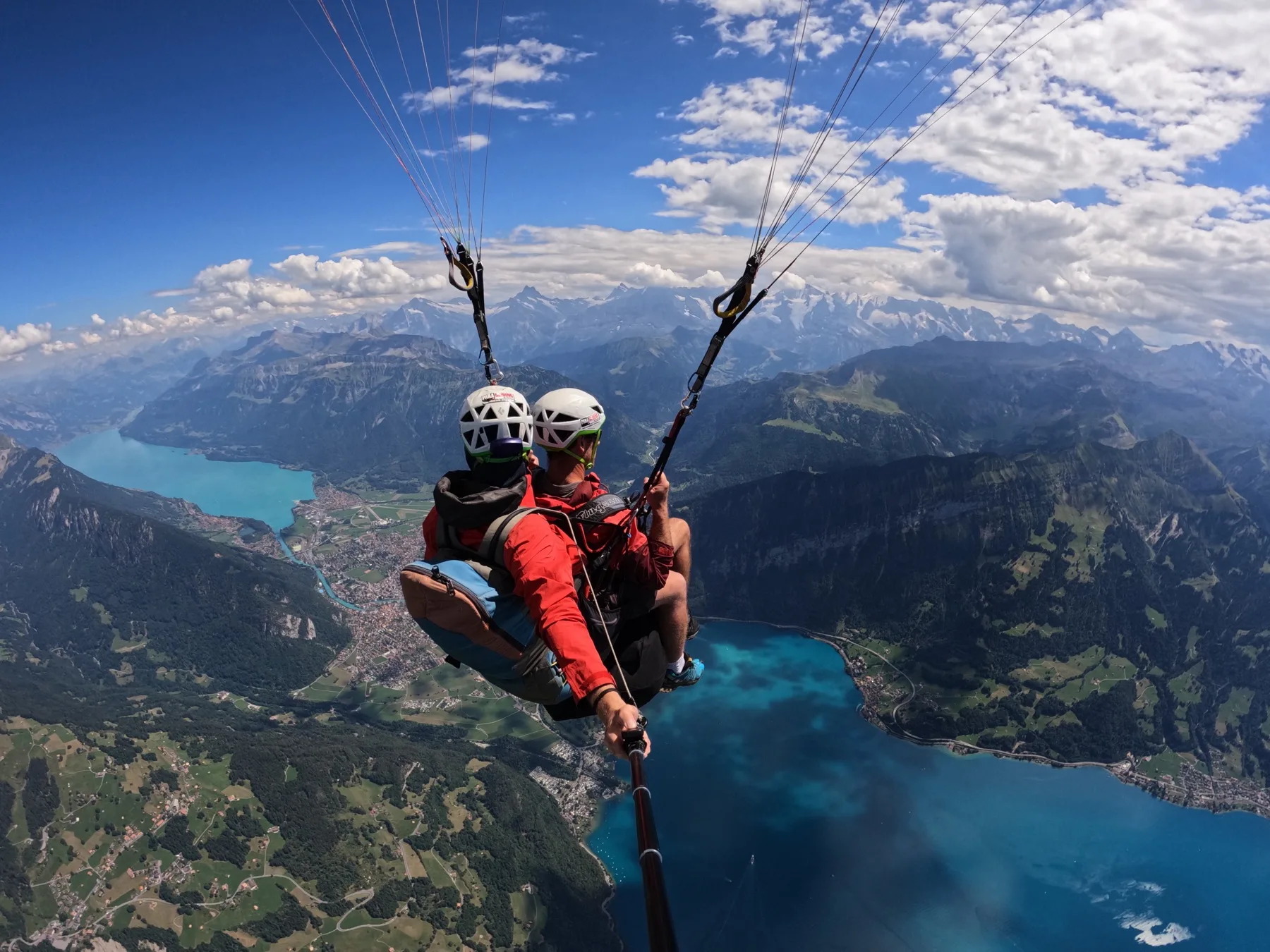
On a clear day, three famous peaks line up behind the lakes.
| Landmark | Height |
|---|---|
| Jungfrau | 4,158 m |
| Mönch | 4,107 m |
| Eiger | 3,967 m |
| Highest launch (Hohwald) | ~1,600 m |
| Main launch (Amisbühl) | ~1,350 m |
| Interlaken town | ~570 m |
Lake Thun sits to the west of town and Lake Brienz to the east. From the air you see both at once, which is the view most people come for. More on the two flying areas in why Interlaken.
Month by month
Long-term averages for the Interlaken weather station, 1991–2020. Useful for picking a month, not for picking a day.
| Month | Avg. high | Sunshine | Rainy days | Rain |
|---|---|---|---|---|
| Jan | 3.2 °C | 67 h | 9 | 72 mm |
| Feb | 5.4 °C | 82 h | 9 | 67 mm |
| Mar | 10.5 °C | 129 h | 10 | 73 mm |
| Apr | 14.7 °C | 164 h | 10 | 83 mm |
| May | 18.7 °C | 183 h | 13 | 122 mm |
| Jun | 22.4 °C | 200 h | 13 | 127 mm |
| Jul | 24.3 °C | 223 h | 13 | 146 mm |
| Aug | 23.7 °C | 199 h | 13 | 146 mm |
| Sep | 19.2 °C | 152 h | 10 | 94 mm |
| Oct | 14.1 °C | 102 h | 9 | 80 mm |
| Nov | 7.8 °C | 68 h | 10 | 80 mm |
| Dec | 3.7 °C | 57 h | 10 | 91 mm |
For the day itself, use the live forecast on best time to fly.
Budget
Typical 2026 prices. Always confirm the current price when you book.
| Item | Typical price |
|---|---|
| Standard tandem flight | CHF 170–210 |
| Photo and video package | ~CHF 40 |
| For comparison: tandem skydive | CHF 425–690 |
More detail on what's included, or see how it stacks up in paragliding vs skydiving.
From my logbook
Where the advice on this site comes from.
| Started flying | 2006 |
|---|---|
| Flying tandem in Interlaken since | 2011 |
| Tandem passenger flights | 16,000+ |
| Average per year | ~1,000 |
| Flyable days a year in the region (my estimate) | 300+ |
| Tandem paragliding deaths in Interlaken since 2011 | 0 |
That's a lot of takeoff runs, and a lot of the same five questions at launch. Most of the answers are on this site. On the safety figure: there have been serious accidents over the years, but no tandem deaths in my time here, and none that I know of before it. More on that in the safety guide, and more about me on the about page.
Quick answers
Tandem flights launch above Beatenberg from Amisbühl, at about 1,350 m, or from Hohwald, the highest takeoff at about 1,600 m. Interlaken town is at about 570 m, so you glide down roughly 800–1,000 m to land in Höhematte park.
July, with about 223 hours of sunshine on average (1991–2020). December has the least, around 57 hours.
About 127 days a year have at least 1 mm of rain, but a rainy day is rarely a day without flying. In my experience the region has over 300 flyable days a year: we often wait out a shower and fly later, and cancelling a whole day is rare.
Usually 10–20 minutes in the air, and about 1.5–2 hours from meeting your pilot to landing back in town.
Planning a trip?
Tell me when you're coming and who's flying. I'll tell you honestly what the numbers usually look like that week.